On November 15, 2023, the Board of County Commissioners (BOCC) directed Planning Commission and County staff to provide a report on possible geographic areas that the BOCC might consider for future expansion of the existing Urban Service Area (USA) boundary and what public and private funding options exist for providing infrastructure and services commensurate with new development.
The Urban Service Area is both a boundary on the Future Land Use Map and a strategy to focus 80% of new
growth and redevelopment within that boundary aligning with public and private infrastructure investments.
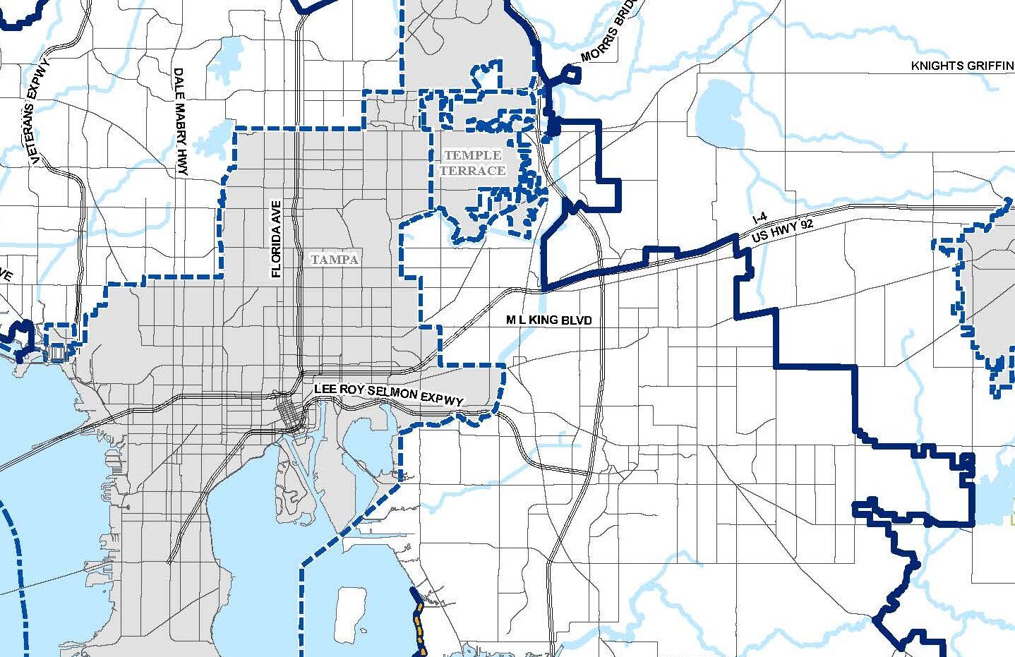
The land within the Wimauma Village Residential-2 (WVR-2) and the Residential Planned-2 (RP-2) future land use will be examined for expansion of the Urban Service Area boundary.
Areas along and around the I-4 Corridor and Little Manatee South, as shown on the map, will be studied further. This would include further refinement of study areas, infrastructure needs and land use assessments.
A timeline has not been established but the study is anticipated to be a phased, multi-year process that will include extensive public outreach. At the time a schedule is established, it will be made available on this webpage.


We encourage engagement, please let us know what you think!
Sign up to receive email updates on this project.
Sofia Garantiva, AICP | [email protected]
Andrea Papandrew, AICP | [email protected]
Persons needing assistance reading or interpreting items in this document, free of charge, are encouraged to contact the ADA Coordinator at (813) 272-5940 or [email protected] . Plan Hillsborough (the Planning Commission, the Hillsborough TPO, and the Hillsborough River Board) cannot ensure accessibility for items produced by other agencies or organizations.
Plan Hillsborough (the Planning Commission, Hillsborough TPO, and Hillsborough River Board) assures that no person shall, on the grounds of race, color, national origin, sex, gender identity, sexual orientation, age, income, religion, familial status, or disability, be excluded from participation in, be denied the benefits of, or be otherwise subjected to discrimination or retaliation under any agency activity or program. Learn more about our commitment to nondiscrimination and diversity. For more information contact our Civil Rights Officer at (813) 946-5334 or [email protected].
Under Florida law, e-mail addresses are public records. If you do not want your e-mail address released in response to a public-records request, do not send electronic mail to this entity. Instead, contact this office by phone at (813) 272-5940. Please note that our phone system can capture a voicemail as a recording, which if emailed may also be subject to a public-records request.